Wednesday 26 September 2012

Well I knew Australia was big, but seriously. WA really does take the biscuit. You can drive all day out here and barely make an indentation on the map - just your wallet, with the price of gas nudging $2 a litre.

I'm writing this from a little spot just out of Exmouth, which is a sea port around 1200km or so north west of Perth on Australia's west coast.

We're camped in a lovely little strand of pine trees right on the beach, just next to a large 'No Camping' sign, which we're hoping doesn't apply to us.

Since my last post we've logged another 1000km or so behind the wheel, and really all we've done is nip down to Karajini National Park and back out to the coast again.

Karajini is awesome. If you like canyoning, you've got to go to Karajini. Huge chasms split the hillsides, with deep ravines and crystal-clear swimming pools. It's hot, but then the pools are really cold, so it sort of balances itself out.

Stunning canyon in Karajini National Park

Karajini is one of those places you don't want to be in a flash flood. We read several stories of heroic rescues of tourists who went beyond the signs that say 'Don't go any further' (we do listen to those sort of signs) and either fell or got stuck.

In one tragic case a few years back, a bunch of rescuers who were waiting for a chopper in one of the canyons after picking up a stupid tourist who broke his leg got swept away by a flash flood and one of them drowned.

His memorial  is in the park.

Sunset at Cape Leveque

We also loved Cape Leveque, just above Broome. Amazing red cliffs, white sand, and blue blue ocean. Koolaman Resort, right at the end of the road, is to die for, if you've got the cash to splash on a room. We didn't - we camped instead - but it was still amazing, with a beautiful white sand swimming beach.

After Karajini we headed through Tom Price - yes, there really is a town called that - and had our photo taken next to one of those mammoth yellow mining trucks. Rio Tinto pretty much owns all the land around there, including its own railway, Pilbra Iron.

We got a permit to drive down Rio Tinto's railway access road, which is a short-cut back out to the west coast. All we had to do was sit through a very painful 20 minute DVD, which explained how dirt roads can be very dangerous, how taking drugs and drinking alcohol is not a good idea when you're driving (who knew?) and that one shouldn't look at the big trains while driving for fear of getting distracted!

We followed most of the advice but couldn't resist waving to the drivers of the mammoth iron ore trains, each some 2km or more in length. We even got a blast from the engine's horn for our efforts!

Free camping along the coast

We wanted to visit Millstream Chichester National Park on our way back to the coast, but a massive Outback fire had closed the road, so we ended up having to do a detour north to the mining town of Karatha, just to add another couple of hundred k's to the odometer.

We're really looking forward to Cape Range National Park, which is just beyond Exmouth, which promises coral reefs and some good snorkeling.

The westernmost point on the Australian mainland is just south of there, so we'll have to bag that on our way down to Perth.

Now THAT'S a 4WD!!!


Wednesday 19 September 2012

Gidday from Broome, Australia's pearling capital, although these days this far-flung hamlet surrounded by a sea of red dirt makes its living from tourism, in particular the backpacker market. Pearls before swine, you might say.

It's a funny little place, Broome. It's civilisation, of a sort - there's mobile phone reception, supermarkets, a couple of decent places to get a bite and even some plush resorts if you've got the cash.

But it's the wild west, nonetheless, as perhaps befits a town that's still some 2000km from Perth and 1800km from Darwin. Everyone has travelled an awful long way to be here and they're determined to have a good time.

Broome has a wild past too. The colonials used to force aboriginals to dive for pearls because they were too scared to do it themselves, and grew fat off the profits. A lot of aboriginals drowned.

Nice to sea ya: A sunset dip in the briny at Broome's Cable Beach

Then the Japanese came along with a diving suit they'd invented and pretty much put the colonials out of business, much to the relief of the land's original inhabitants.

Broome ended up a mash-up of cultures and peoples seeking their fortune at the north-western tip of The Big Empty, as they call this part of Australia.

So don't be fooled by Broome's marketing as a resort town. True, it's 30 degrees in the middle of our winter and the sea is a beautiful aqua marine blue. But there's a strong local culture too - and by the way, we counted three large crocodiles just off the main swimming beach this afternoon, which you won't read in the tourist brochures either!

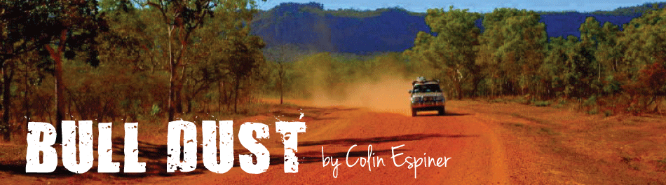
We got here by travelling 1000km or so from Kununura, where I signed off my last post, along the Gibb River Road.

Now, some of you may have heard of the Gibb River Road. It's billed as Australia's greatest 4WD adventure drive; the last truly remote frontier in the country in the 21st century, and a road upon which danger lurks beneath every pothole.

Bollocks.

Here's the truth: If you have any 4WD experience, or even if you just possess modest driving ability and a reasonably decent vehicle, you'll find it a highway. I reckon I could have done it in my nana's Mini.

It's a shame really, because the marketing department has really been allowed to run away with all the hyperbole spouted about the GRR. The reality will disappoint those really looking for a remote wilderness experience but delight those whose idea of roughing it is a few miles down a corrugated road and a bit of dust before retiring to a luxury wilderness lodge for the night with crisp bed sheets and full board.

If you want a real 4WD experience, try one of the deserts like the Simpson, or of course Cape York, where they measure corrugations by the foot and their idea of fine dining is a roadhouse mince and cheese pie.

An idyllic camp spot on the shores of Admiralty Bay

We managed to spice things up a little by driving some 250km north from the GRR along a back-road to Mitchell Falls, which are well worth the journey, and then down a pretty rough track until we reached the sea  at a place called Admiralty Bay - the first time we'd seen the big blue since leaving Darwin a month or so back.

We camped overlooking the bay, hundreds of miles from anywhere and all by ourselves, watching the crocs cruise up and down off the beach as the sun set. Magic.

Yeah, she's a big country all right

Also amazing although more touristy was Tunnel Creek, well worth a diversion off the GRR. Tunnel Creek is an incredible underwater cave system that runs beneath the Napier Range in the Kimberly. You can walk/wade all the way through to the other side if you've got a good torch and you're not scared of bats or crocodiles.

Seriously, we were wading through the river by torchlight and we came face-to-face with a croc. Fortunately it was a freshie, deemed 'mostly harmless unless provoked' but that doesn't calm the nerves much when you make its acquaintance at close quarters. I mean, has anyone told fresh water crocodiles that they're harmless? They still have big teeth.

We've had two days of recovery in Broome, and tomorrow we're heading up to Cape Leveque on the north coast to stay in an aboriginal-owned community campground before turning south to drive across the Big Empty to Port Headland.

Magnificent Mitchell Falls, off the Gibb River Road


From there it's briefly back inland to visit Karajini National Park before heading back to the coast for the final  1500km run down to Perth and the finish of our journey.

Tuesday 11 September 2012

Well I've been through the desert in a car with a name.

I can't say it felt good to be out of the rain, given it hasn't rained on us in about three months now. It would have also been quite surprising had it rained, given we were in the Tanami Desert, which has negative annual rainfall if you count evaporation.

But it was still an experience.

It took us three days to drive the 1000km across the pancake-flat Tanami. You could do it in two, but we found driving at 80 km/h on a fairly rough corrugated road was hard enough without pulling really long days.

A highlight was camping under the stars with a big bonfire. Amazing how clear the sky is without any light pollution, except for the odd road train that came thundering through on its way to one of several mines we passed along the way.

Camping under the stars


We're back up in the Top End now, in Kununura, a pretty little service town in the Kimberly, Western Australia, which serves as the stock-up place for everyone about to head west along the Gibb River Road or east along the Victoria Highway towards Darwin.

It's been an eventful week or so since my last post. From Uluru we took a rough 4WD track through the amazing Finke National Park to a place called Boggy Hole (incidentally, if you're wondering why it's called that, it's because most people get stuck in the sand driving through there...and we were no exception!)

Palm Valley

We camped on the Finke River as wildfires raged all around us. That night I counted 16 separate blazes in the distance. Pretty scary stuff, but fortunately none came near us. My escape plan had been to drive into the river!

Then we headed into Palm Valley, an amazing canyon that somehow has allowed palm trees to grow in the dry thanks to underground streams and plenty of shade. It was spoiled only by a tour operator who gave us another reason to hate them, allowing his guests to pitch their tents all around our own camp. I asked one guy who was setting up directly under our awning if he'd rather sleep in our tent too! I don't think he got my sarcasm.

Digging out Chuckie in Boggy Hole!

Complaining didn't do much good as it turned out the group, from one of the big roading companies, had been invited by the local aboriginal elders. That explained why they didn't understand camp ground ettiquette, but it didn't put any more hot water in the tiny camp ground's solar shower.

Most of the time we've stuck to bush camping, which has the advantage of being free and allows you to avoid the hoards as much as possible.

Not sure how we'll fare in the next week though - the Gibb River Road is a highlight in any 4WDers itinerary, although luckily we're through the peak winter season now, and many fellow travelers are starting to head south.

It's really heating up - Kununura was 37 degrees yesterday, and the forecast is for 38 today. Ouch.

Sunset in the Tanami Desert


Wednesday 5 September 2012


Uluru:  Even the name sounds mysterious, grand, remote, awe-inspiring. A red rock rising nearly 350m out of the desert plain, hundreds of kilometers from anything and anywhere – surely the most recognisable natural attraction in the entire country.

No matter how many postcards you’ve seen, Uluru is still breathtaking, particularly up close, where the fissures in the rock look like pockmarks on suede and its colour deepens as the sun goes down.

It’s big, sure – 3.6km long by 2.4km wide, and old – around 600 million years they reckon.

But it’s not the size that matters, on this occasion anyway. There are plenty of other big pieces of rock in Australia.

Uluru at sunset


It’s partly the fact that it’s such a surprise. There is literally nothing else around it. The Olgas, a small group of hills that look like something out of a story book by Dr Suess, stand some 70km away, and there’s Mt Connor, an even larger, flatter mountain that many visitors mistake for Uluru as they head towards it.

But in an area that comprises hundreds of thousands of square kilometers, that still adds up to two-thirds of sweet nothing.

It has been of huge significance to Aboriginal people for millennia. The traditional belief is Uluru was created by two boys playing in the mud.

And it’s also the journey itself. Even Alice Springs, the geographical centre of Australia, is still 400km away. It seems to take forever to drive there. And much, much longer to walk.

On top of the world - well, Uluru, anyway

Perhaps that’s why Uluru has attained such mythical status. For if it’s still possible to undertake a pilgrimage to the heart of the Australian dream in the 21st century, Uluru is such a trip.

It’s a rite of passage for young Australians, and a bucket list opportunity for the grey nomads. Tourists flock here, backpackers congregate in their vans alongside the road to gape in awe, 4WDers combine it with a trip through the Simpson and Tanami Deserts.

And like any good pilgrimage, it has controversy. To climb, or not to climb? That is the question.

The Aboriginal custodians of Uluru, the Anangu, ask you not to. Signs everywhere plead with you not to climb the rock. To them, it’s a culturally insensitive.

To non-aboriginals, it’s an opportunity to climb the most famous rock in Australia, with the reward of incredible sweeping views of the desert plain.

In the middle is the Australian Government. So far, the rock remains open to climb – some days. It’s often closed due to a variety of reasons (some say excuses) – wind, temperature, or by Anangu request.

It's a long, and very steep way up and down

Many believe Uluru won’t remain open for climbing much longer. There are no signs showing you where to ascend, and the local park headquarters doesn’t even mention it unless you specifically ask.

There is, however, a large sign listing the health risks of climbing, and warning that 35 people have died trying.

We chose to climb. Without wishing to invoke the wrath of whatever Aboriginal spirits hang over the place, it’s just too tempting to pass up this once-in-a-lifetime opportunity.

It’s a bloody tough walk. The route goes virtually straight up for the first 600m. There’s a chain you can grab to stop you slipping to your death. Your lungs ache, there’s no shade, and it’s over 30 degrees.

But the elation at the top, 843m above sea level, is worth it. The views are incredible. Interestingly, there’s a plaque at the top describing it as Ayers Rock, a name used as little these days as Taranaki is called Mt Egmont. It was erected in 1973.

It seems to me another indicator the Government is planning to shut Uluru in the not-too-distant future.

If you’re keen on seeing what all the fuss is about, plan your trip there soon.

Pockmarks on the velvet surface of Uluru