Wednesday 29 August 2012

Do you remember the last time you were really, really sick?

I'm talking puking your guts out, here - writhing on the bathroom floor in agony as your stomach tries to find the very last piece of bile left in your system.

Remember? Well now transplant that bathroom floor to the dusty Outback, on your hands and knees in the dust and prickles, 32 degree heat, no shade, dry retching.

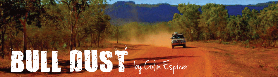
That was me yesterday, courtesy of a dodgy  barra burger at the Daly Waters pub, a popular watering hole about 600km down 'The Track' as the locals call the Stuart Highway between Darwin and Alice Springs.

I just wanted to curl up in a ball and die quietly, but unfortunately that wasn't an option in the middle of nowhere so we had to keep going until we could find a motel room where I could lie in air-conditioned comfort and feel sorry for myself.


Daly Waters pub, home of the dodgy barra burger


There was one just down the road, actually - well, 500km away, which is just down the road around here.

It took nearly five hours even at the speed you're allowed to drive on the open road to get to Tennant Creek, where I'm now propped up in bed while Katie fusses over me.

You can travel at 130km/h in the Northern Territories on some of the highways. Until yesterday, we'd stuck to 100, mostly because the cruise control I self-installed resolutely refuses to go any faster (I reckon it was made in NSW) and I can't be bothered sitting with my foot on the accelerator all the time.

But yesterday we felt an exception needed to be made. The road stretched in a thin straight line until it met the horizon, shimmering in the heat. Other vehicles roared past us as if we weren't even moving. In this landscape, at the legal open road limit in New Zealand you seriously feel you could get out and walk alongside the car for a bit to stretch your legs.

Local sense of humour

So we had a little chat to Chuck the Truck about going a bit faster, and it turned out that while he wasn't overly keen on 130km/h he was happy enough with 120.

After leaving Darwin a week ago, we headed through Litchfield National Park, which was absolutely jammed with NT weekenders making the most of the amazing waterfalls and plunge pools to beat the heat.

We couldn't help comparing Litchfield to Kakadu, the NT's two famous national parks. The conclusion we came to was this: If you like swimming and waterfalls, go to Litchfield. But if you want grandeur on a truly large scale, then Kakadu is for you.

Wangi Falls, Litchfield National Park

We're now only around 400km south of the Red Centre, Alice Springs, which is as far south as we're going on this roadie before we turn and head up through the Tanami Desert to Halls Creek and the amazing Kimberly, home of the infamous Gibb River Road.

Well, I hope it's infamous. I do like a challenge.


Friday 24 August 2012

Darwin: What does it mean to you? We've all heard of it; most of us have never been there. It's one of those far-off places you never really need to go to that's not really on the way to anywhere.

Until recently my experiences with Darwin had been refuelling stops.

The first time I was travelling with Prime Minister Helen Clark and her party on our way to East Timor to join in the independence celebrations. I remember it was boiling hot, and we were accommodated not in the salubrious abodes I had become accustomed to following around the PM, but at the Darwin Air Force barracks.

I was assigned a tin shed for the night. The air con didn't work and the bunks had no sheets or pillows. There was nothing for it but to go out and get hopelessly drunk, which I managed so well that I couldn't remember which hut was mine when I finally staggered back from town.

Darwin's sunset market

I ended up breaking in to another barrack, fortunately unoccupied, collapsing unconscious on the bunk, and finding my way back to my own assigned hut the following morning just in time for roll call.

 The second time was slightly less boozy but for the same reason - a refuelling stop on the way to Bali for a winter holiday.

Indeed air craft have used Darwin for this purpose for yonks. Qantas used Darwin as its major fuel stop for all flights heading to Asia and Europe right up to around 30 years ago.

The Japanese also found reason to stop in Darwin - just long enough to drop bombs on the place during World War Two. It's a little weird to think our neighbour, so close to home, was bombed during the war, but then Darwin is a lot closer to Bali than it is to Bondi - let alone New Zealand.

There's a big memorial to the devastation caused by the Japanese on Darwin's spiffing new waterfront complex, down on the harbour. It makes for sobering reading.

The redeveloped waterfront in Darwin - complete with wave pool and shark net

Darwin is a city that's used to being flattened, sadly. The Northern Territory Museum up here has an amazing and quite heart-wrenching exhibit on Cyclone Tracy, which tore through the city on Christmas Eve, 1974, smashing the place to pieces.

More than 90 percent of the town's houses were destroyed, more than 70 people lost their lives, and something like 19 boats sank during wind gusts of over 270 km/h.

It's amazing Darwin recovered, but it has - and that brings me to my third visit here. Finally, I've left the airport, and the drinking strip on Mitchell Street (which I couldn't remember anyway). And I've been pleasantly surprised.

Darwin isn't really a city, even though it calls itself one. It has a few high rises, but they're all apartment blocks, and the CBD is only three streets wide. But it's big up here, and when you've been driving through the Outback for a month and the most impressive sign of civilisation you've seen is the pub in Borroloola, it may as well be Sydney or even London.

There's a laid-back vibe, befitting a tropical capital. The locals stop work at 5pm, and good luck finding much open before 9am. The sunsets are magical, the beer's cold, and there's plenty of pubs doing a decent barra and chips - or a curry, if you'd prefer.

Darwin's proximity to Asia means the cuisine up here runs the full Pacific Rim gauntlet - Sri Lankan, Indonesian, Vietnamese, Thai, Japanese, Malaysian, Indian - take your pick.

Last night Katie and I went down to the sunset market at Mindil Beach; a must-do for any visitor to Darwin. Every Thursday and Sunday evening, the entire town it seems congregates on the sand to watch the sunset, while in the park behind food stalls and markets set up selling every conceivable dish and bric-a-brac.

Life's a beach: Sunset on Darwin's Mindil Beach


The place is a mess of tourists, locals with their kids, vendors touting their wares, screeching birds, and some old bloke blowing on a didgeridoo. It's magic.

We've used Darwin as a bit of a refuelling stop ourselves. Chuckie got a long-overdue service and its third windscreen since we set out and we managed to replace some of our camping gear that broke or got smashed along the way.

Tomorrow we're heading for Litchfield National Park, to the south-west of Darwin, before plunging into the Red Centre for a few days in Alice Springs.


Monday 20 August 2012


Australian Wildlife – An Occasional Series

The Grey Nomad: ageus caravanius

Natural habitat: Victoria and South Australia. Found in the winter months throughout Outback and northern Australia. Mostly docile, but can turn vicious when provoked.

The Grey Nomad spends summer in the southern states of Australia, mostly out of harm’s way, watching the races, knitting socks for the grandchildren and betting on the pokies.

But come the cold winter months they take flight and head en masse for the warmth of northern Australia.

Flight is hardly the word, though, for this particular bird. With a girth equaling the Titanic, a voice like that doomed ship’s foghorn and an accent that makes Julia Gillard sound like she’s taken elocution lessons, the Grey Nomad can be quite an off-putting sight.

Usually travelling in flocks, the Grey Nomad likes company. So much so, they will pull up directly beside your tent in an otherwise empty campground and proceed to set up camp. This usually takes several hours and involves the careful placement of a washing line, a shower, and a satellite dish.

Yes, Grey Nomads have cable. They also have more money than you. So while you wash the dishes by torchlight, you can listen to the Grey Nomad watching the Olympics.

The other advantage of the Grey Nomad’s love of proximity is the chance to learn more than you ever wanted to know about which health insurer has the best cover on hip replacements, which colostomy bag works best in a caravan, and the merits of corned beef over spam for dinner.

The Grey Nomad might be nomadic, as the name suggests, but they also love to stay awhile.  They have nothing better to do, and after all, they’re spending your inheritance.

So when you pull up at a particularly tricky river crossing, you can be sure there will be a bunch of Grey Nomads sitting on the other side, deck chairs out, drinks poured, ready to see whether or not you make it across.

Yes, alas, the Grey Nomad does come in a 4WD variant. This sub-species exists thanks to off-road camper trailers, which allow this otherwise bitumen-dwelling creature the chance to truly spread their wings to the dirty roads of Outback Australia.

Which means that just like the blowfly, they are pretty much everywhere.

Even when you are parked up for the evening in the most isolated spot imaginable, it’s usually only a matter of time before Ron, Esther, Harold and Mabel round the bend, ready for a good game of scrabble.

And as you drift off to sleep at night, the last thing you’ll hear is a debate over whether tonight is a wooly singlet night – conjuring an image sure to stalk your dreams all night long.

The Grey Nomad, like most birds, awakes early, with a clattering of pots and pans.

Then it’s off the next destination – and it’s the same way you’re going.    

A grey nomad in the wild. Note the satellite dish on the right. 


Saturday 18 August 2012

Wow it's hot.

I'm sitting here at one of those park bench tables they have in campgrounds, willing the sun to drop so it will cool down a little.

A stilt takes a walk through the wetlands of Kakadu, Note the interested croc on the left!

We're in Kakadu National Park, Australia's stunning, 20,000 sq km icon, a place of waterfalls, rivers, escarpments, billagongs, wetlands, walking trails, and heat.

Kakadu doesn't do cold. It has six seasons, according to Aboriginal lore - cool dry, hot dry, stormy, hot wet, misty, and monsoon.

We're in the hot dry. It's 34 degrees in the shade - what there is of it - and it's a dry heat. So dry I went and stood in the campground shower before with my clothes on half an hour ago and they're dry again already.

Apart from the heat, Kakadu is nothing short of incredible. The park supports hundreds of varieties of birds and other wildlife, picturesque lakes and rivers, stunning waterfalls with plunge pools you can dive into without any fear of touching the bottom.

And crocs. Lots and lots of crocs.

We went on a riverboat cruise today on South Alligator River (named by some European who thought the crocs were alligators). There they all were, dozing in the sun, 5m-plus of lethal killing machine.

Our tour guide told us just how powerful the jaws of a crocodile are. I can't remember exactly how many pounds per square inch it was, but it was a lot. The locals say if you are either unlucky enough to fall in a croc-infested river or stupid enough to swim in one you've got about 30 seconds from point of contact with the river to goodnight nurse.

Fortunately, there are those plunge pools, hundreds of metres up above the rivers, where you can call off - although even then, the signs make it perfectly clear that you swim at your own risk.

The thing is, when it's boiling hot and the water is lovely and cold, it's sometimes hard to make a rational decision. But so far we've been OK.

Kakadu sits around 300km or so south of Darwin. We got here through the back roads, through Limmen National Park, another awesome stretch of Northern Territory wildnerness. It was around 400km of nothingness, but it had its own fragile beauty - particularly Butterfly Springs, an oasis in an otherwise barren and dry land.

A big saltie!


The Northern Territories does things its own way. It's the only place in the country where mining is permitted in national parks for example - cue hue and cry from the greenies - and it has an open road speed limit of 130km.

Until 20 years ago, there was no speed limit at all - the locals weren't very impressed with the imposition of 130km, although I have to say the average vehicle around here doesn't look capable of it anyway.

It's also the first place I've come across where there's a limit on how much booze you can buy in a day. Basically, it's a couple of bottles of wine, or a bottle of spirits, or a slab or two of beer. The details are entered into a computer, matched against your licence, and if you try to buy any more anywhere in the state on the same day, you're out of luck.

Kakadu wetlands on the South Alligator River


A plunge pool above upper Edith Falls in Katherine Gorge National Park

The system was originally introduced to try to curb alcoholism among aboriginals but it now applies to everyone, and unless you're planning a massive party I think it's a pretty good idea.

We've now reached the half way point in our journey to Perth and we've already covered 9,100km. I can't wait for Alice Springs and the Tanami Desert, while my girlfriend is looking forward to the beaches of western Australia.

So little time, and so much to see.

Wednesday 15 August 2012

It’s been a few days and quite a few miles between posts. This is partly because it’s been too darn hot and dusty during the day and too dark at night.

But mostly it’s because Telstra, while it might be the Government-owned phone company, doesn’t have very many repeater stations once you get out in the bush.  As for the other networks, forget it. If you don’t live in a main centre, you don’t exist as far as they’re concerned.

Sunset over the Gulf of Carpentaria from Karumba


Seriously, Australia is a truly massive country. And there’s not very much of anything once you get off the beaten track.

A slow day on the Mitchell River crossing

The Normanton croc - at more than 8m, the biggest ever captured


It’s funny what you get used to. Only six weeks ago I’d stop at traffic lights in Sydney and wave away window washers who wanted spare pennies to clean your screen.

Now I stop at river crossings, don the jandals, and casually stroll across to check the depth before driving over in the truck, one eye out for crocs and the other for potholes. Such is life in Outback Australia.

I’m writing this at Kingfisher Camp, an Outback station in rural Queensland, near the border with the Northern Territories.

It’s 630pm, still light, and about 26 degrees.

Today we drove up from Lawn Hill, a fabulous national park in a limestone river gorge inhabited by aborigines (and the odd fresh water croc) for thousands of years. Last night at sunset we walked up to the top of the Constance Range, which overlooks the gorge, and watched the colours change on the stone and bush as the sun set a fiery blaze of orange in the west.

It’s so hot and dry here. At night the temperature drops below 10 degrees and we shiver in our sleeping bags but by 9am the mercury is heading back towards 30. The sky is a constant, cloudless blue.

And the dust. Oh, the dust. We were warned about the bulldust. But it’s hard to comprehend it until it’s in every crevice of your body and everything you own.

It gets everywhere. Chuckie is now a red truck rather than a white one. And I’m not sure my tan is genuine either.

I signed off my last post from the tip of Cape York. Suffice to say we made it down again OK, although our windscreen is about to fall out from all the rattling. It’s currently held in with blu-tac and wads of paper.  Hopefully it will last until Darwin.

After we got back down we headed west across the Gulf of Carpentaria to (Ay) Karumba!, a town on the Gulf Coast whose main claim to fame, apart from the fabulous sunsets and the fishing, is that it’s the only town with sealed road access on the entire, 1000-km stretch of the gulf. Think about that.

The distances out here are mind-boggling, particularly for Kiwis. I’ll look at the map and say, ‘’that looks like a good spot, let’s just whip down there.’’

My girlfriend will peer over my shoulder and say “sure, that’s 580km away’’. Everything is a long, long way away. And sometimes the landscape doesn’t change much for hours at a time. But it has its beauty, especially in the twilight when the temperature drops and the setting sun bathes the land in a warm glow.

Tomorrow we’re headed back in time, literally, over the border into the Northern Territories. Time to put the clocks back and then check out Limmen, Australia’s newest national park – approved just two weeks ago.

Then it’s onto one of Australia’s oldest, the famous Kakadu, before finally hitting the tropical NT capital of Darwin, still some 1000km distant.

It's a wide open road


Sunday 5 August 2012

Well,  we knocked the bastard off, as Sir Ed was wont to say.
OK, it wasn’t exactly a 12,000 metre mountain, but Cape York was our Everest.
Standing by the somehow strangely nondescript sign informing us that we were at mainland Australia’s most northerly point, it was almost an anti-climax after six weeks and over 5000 km of driving on everything from tarmac to bulldust, sand to rocky river beds.
But it felt pretty good all the same.
The last few days have been spent traversing the OTL, which stands for the Overland Telegraph Line, or as the locals call it, The Track.
It isn’t for the faint hearted.
I have to say there were quite a few times when I thought Chuckie was unlikely to make it.
For the uninitiated,  the Telegraph Track is a very rough single lane route taken by the original telegraph cable that ran all the way to the tip of Australia until it was replaced by a microwave link in the 1980s, and now by Telstra fibre optic cable.
The original track was mostly navigated on horseback and later by 4WD, and the 120km or so of it that still remains is not maintained, except by the drivers who use it.
It ranges from pretty reasonable to downright hair-raising, with steep drops down river banks into gullies, stream crossings that go over the bonnet, and sandy, corrugated tracks.


Chuckie navigates the notorious Palm Creek crossing


I should have known what we were in for when we arrived at the first major creek crossing to find an audience in attendance. People had placed deck chairs along the top of the banks, poured themselves drinks, and had sat back to watch those brave enough to try to get across.
I’m not making this up. You could have sold tickets.
Those who made it received a round of applause. Those who got stuck got an even bigger round of applause. Those who knocked bits off their vehicles got whistles and cheers.
We weren’t sure if our humble little truck would make it, so we decided to camp by the river and sleep on it. Surely it would look better in the morning, we reasoned.
It didn’t.
 But a nice bloke called Tom and his lovely girlfriend Bella offered to winch us out, if we got stuck. That was enough of an insurance policy for me, and I inched Chuckie down into the creek.

On the Telegraph Track

The drop in was so steep I mostly slid down, but managed to avoid nose-diving into the bog at the bottom. Just.
A round of applause.
Then it was just a matter of getting up the other side. I had a few goes, but only got a handful of metres each time before sliding back down. A kindly old chap with a spade dug some sand in behind the wheels for me and then lent through the window.
“Kick her in the guts, son,’’ he advised.  “Give it heaps.’’
Throwing caution to the wind I floored the truck and to my surprise (and everyone else’s) Chuckie clawed its way up the other side and out, to a standing ovation.
Much bigger vehicles than ours had required winching out, so we were pretty pleased with ourselves.
We spent the next three days traversing the OTL, camping by the crystal-clear streams, swimming in the croc-free water, and marveling at our surroundings, which ranged from dense rainforest to scrub and savannah. It was bliss.
Finally we emerged from the OTL onto the main bypass road (still corrugated dirt of course) to the Jardine River ferry and The Top.
You can cross the Jardine in your vehicle, if you don’t like it very much. Around 100 people a season try at the old ford crossing, apparently, and most end up at the bottom of the river. It’s about 1.5m deep and around 100m wide, with a sandy bottom. And a few rusting car wrecks.
Another bone-jarring 100km on dirt roads saw us to the top.
From the tip of Cape York you look out on the Gulf of Carpentaria where it meets the Coral Sea. Due north is Papua New Guinea, less than 200km away. Bali lies 3000km to the north west; Darwin 1300km to the west. Wellington is 4000km due south.


Lunchtime on the Telegraph Road


The sun beats down from a cloudless blue sky. The sea is a beguiling turquoise. Beguiling because while it looks picture-postcard perfect, it’s teeming with sharks, crocodiles, and stingrays. The 30 degree heat and the white sand beaches tempt you, but no-one swims in the sea up here.
I have to make do with dipping my toe in the sea instead.
After the obligatory round of photos we head back to our camp at Loyalty Beach, where we’ve set up right on the beach front. Tonight we watched an orange sun sink into the sea – a treat for east coasters like us.
Tomorrow, it’s time to head all the way back down the cape before striking west, across the Savannah Way, to Darwin, some 2000km away by road.
Even though we’ll take the bypass roads back down the cape (they avoid the OTL) it still seems an exhausting prospect. Much of it will be on Australia’s ubiquitous outback roads, and already we and everything we own has turned a deep reddish brown from the bulldust.
What was it Sir Ed said about mountaineering? Getting to the top is easy. It’s getting back down that’s the hard bit.


Cape York, at the most northerly point in mainland Australia